3D mapping and survey payloads
Mobile mapping comes down to LiDAR, position and attitude, and time sync. We mount and calibrate the sensors, then turn point clouds and imagery into 3D maps viewable on the web.
Multi-beam LiDAR, 360° cameras, RTK heading and INS on UGVs, robot dogs and drones for indoor and outdoor 3D mapping, plus 3D maps, 3D Tiles and digital-twin platforms.
Recommended sensors
| Type | Model | Notes | Weight |
|---|---|---|---|
| LiDAR | Hesai PandarXT32 | Mechanical spinning 32-channel | 800 g |
| LiDAR | Livox Mid-360 | 3D hybrid solid-state 360° | 265 g |
| LiDAR | Ouster OS0 (Rev7) | Digital ultra-wide | 430 g |
| 360° cameras | Insta360 X4 | Panoramic camera | 203 g |
| RTK GNSS receivers | Unicore UM982 | Dual-antenna heading RTK module | 1.82 g |
| Gimbals and payload pods | DJI Zenmuse L2 | Airborne LiDAR pod | 905 g |
Reference sets
3D surveying
High-channel LiDAR + panoramic camera + RTK heading + integrated INS
Hesai PandarXT32, Insta360 X4, Harxon HX-CH7609A, Unicore UM982, Xsens(Movella) MTi-630; compute: NVIDIA Jetson AGX Orin 64GB module
3D surveying
High-channel LiDAR + panoramic camera + RTK heading + integrated INS
Hesai PandarXT32, Insta360 X4, Harxon HX-CH7609A, Unicore UM982, Xsens(Movella) MTi-630; compute: NVIDIA Jetson AGX Orin 64GB module
3D surveying
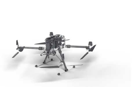
DJI Zenmuse L2, Unicore UM982; compute: NVIDIA Jetson AGX Orin 64GB module
Platforms
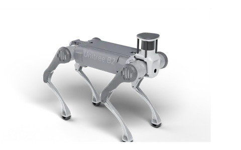
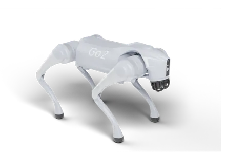
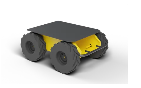
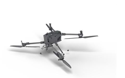
Related services
Custom inspection robot development · Custom robot payload integration · Robot autonomy and system integration
Related projects
- Island-wide 3D map (stylized + photoreal 3D Tiles): Island-wide 3D scene procedurally generated from satellite imagery, road network and building footprints, baked into HLOD 3D Tiles and streamed on web and tablet. The core city also has a photoreal version (procedural per-building models + AI-processed imagery ground + Cycles light baking).
- Photoreal 3D city center (~400 km² 3D Tiles): Procedural per-building models and imagery ground for a ~400 km² city center, baked in parallel on multiple GPU servers into 179 z14 3D Tiles tiles for streaming in the browser.
- 2D/3D platform for power line construction sites: Power line corridor platform built on Cesium and real satellite imagery: extracts buildings, trees, ponds and other features from imagery, with 3D browsing, feature statistics and corridor clearance analysis. A desktop version is also available.
FAQ
- 3D mapping and survey payloads: which sensors?
- Common choices: Hesai PandarXT32, Livox Mid-360, Ouster OS0 (Rev7), Insta360 X4, Unicore UM982, DJI Zenmuse L2. Combined to suit payload, IP rating and accuracy.
- 3D mapping and survey payloads: which robot?
- Options: Unitree B2, Unitree Go2 EDU, Clearpath Husky A200, DJI Matrice 400, DJI Matrice 350 RTK. Quadrupeds for rough terrain, UGVs or drones for large areas.
Tell us about your project
Send the platform, the sensors you need and the use case. We reply with a payload design, weight and power budget, and a quote.
Sales: Li Zhongpan · +86 186 0689 5919 (WeChat) · lizhongpan@yuanzhirobot.com
Engineering: Mo Yuncong · +86 192 6342 5759 · 2211955800@qq.com
Address: Room B602, Hetu Park, No. 500 Shunqing Road, Songjiang, Shanghai 201615, China