Fleet software for mixed robot dog, UGV and drone inspection teams
Updated 2026-11-10 · YUANZHI ROBOTICS engineering team
Short answer: there is rarely one off-the-shelf product that runs a Unitree or DEEP Robotics quadruped, a Clearpath or AgileX UGV and a DJI drone as one team. What works in practice is a thin common layer: an edge agent on each robot that translates its vendor SDK into a shared mission and telemetry format, one site map with a common coordinate frame, a server that assigns inspection points and stores results, and a single operator view. Most of the effort goes into map alignment, data formats and network behaviour, not into the dashboard.
Why mixed fleets need their own software layer
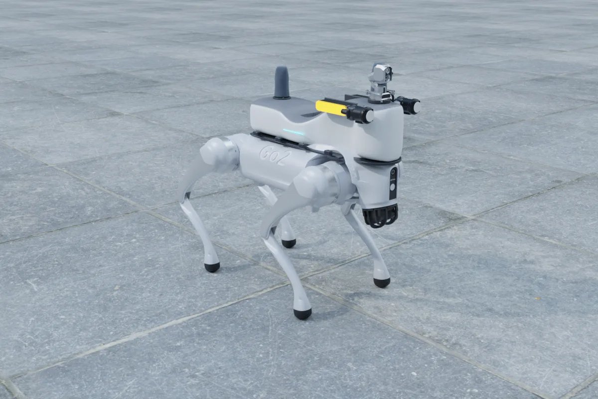
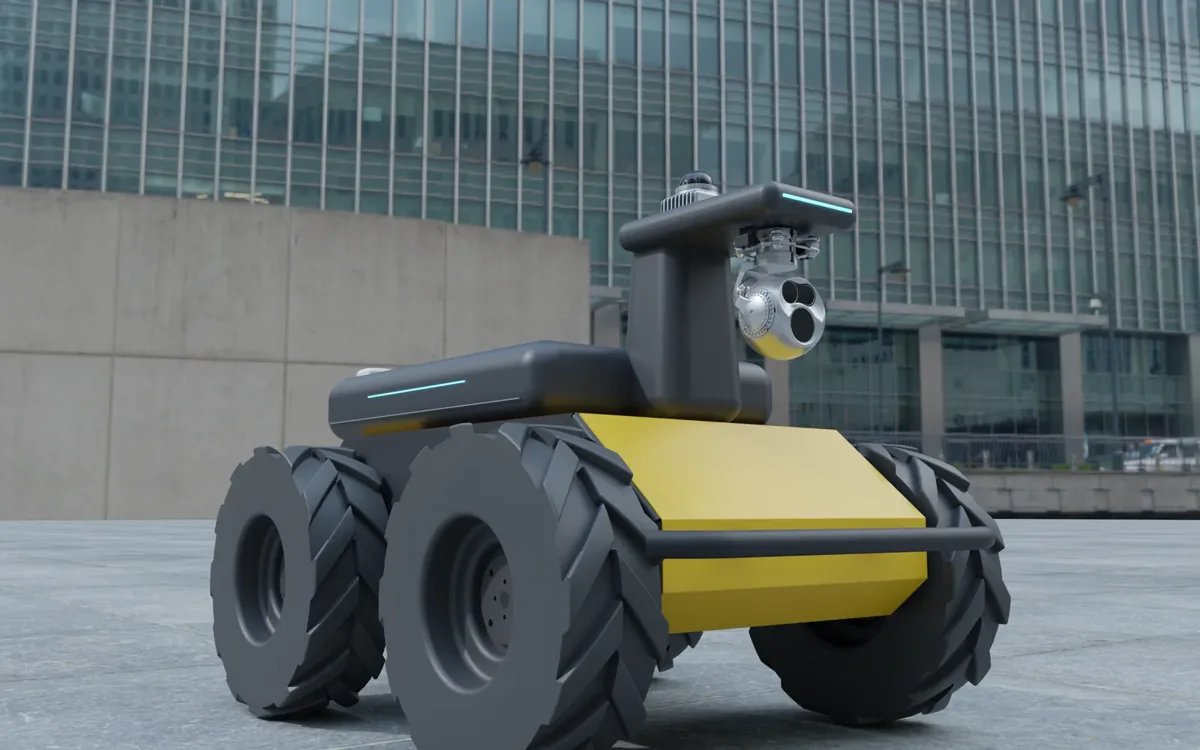
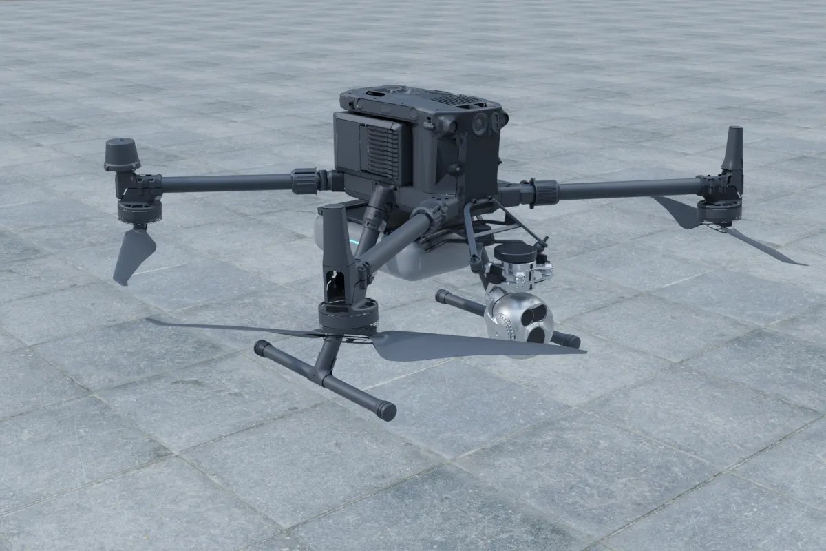
Each platform family ships with a different control interface. Unitree quadrupeds such as the Go2 EDU and B2 are programmed through unitree_sdk2 over DDS. Clearpath UGVs (Husky, Jackal, Warthog) run ROS 2 natively. AgileX bases (Scout, Hunter, Bunker, Tracer) expose a CAN interface with ROS drivers on top. DJI enterprise drones are reached through the Payload SDK on the aircraft, the Mobile SDK on the controller or the Cloud API used by docks. Boston Dynamics Spot uses its own gRPC-based SDK. Vendor fleet tools usually manage only their own robots, so a site that mixes brands ends up with three apps, three maps and three report formats unless something sits above them.
What the common layer actually has to do
- One mission model. An inspection point is defined once (position, heading and a sensor action such as a thermal snapshot of a valve or a gauge reading) and each robot type converts it into its own motion: a walking goal for a dog, a Nav2 goal for a UGV, a waypoint with gimbal angles for a drone.
- A shared coordinate frame. Ground robots normally localise in a LiDAR map with a local origin; drones fly in GNSS coordinates. You need a surveyed transform between the two, or RTK GNSS on the ground robots outdoors, otherwise "point 14" means a different place for each robot.
- Task allocation. Stairs and narrow walkways go to the quadruped, long flat routes and heavy sensors to the UGV, roofs, tanks and stacks to the drone. Simple rule-based assignment by capability and battery level covers most sites before any optimisation is needed.
- Uniform results. Every image, thermal frame, gas reading and gauge value should be stored with the same fields: point ID, robot ID, time, pose, sensor and value. That is what makes trend reports and alarms possible across robots.
- Operator handover. One screen to see positions, video and alarms, plus a clear rule for who has control when a robot needs manual teleoperation.
Integration layer by platform type
| Platform type | Typical native interface | Localisation | What the edge agent adds |
|---|---|---|---|
| Quadruped (Go2 EDU, B2, AS2, X30, Lite3) | Vendor SDK (DDS for Unitree), ROS 2 bridges | LiDAR map, e.g. SLAM with a Livox Mid-360 | Goal and gait commands, stair and docking states, battery mapping |
| Wheeled or tracked UGV (Husky, Jackal, Scout, Bunker) | ROS 2, or CAN with a ROS driver | LiDAR map, RTK GNSS outdoors | Nav2 goals, arm or mast actions, charging dock logic |
| Enterprise drone (Matrice 350 RTK, Matrice 400, Matrice 4T) | Payload SDK, Mobile SDK or Cloud API | GNSS / RTK | Waypoint and gimbal translation, geofence checks, media download |
Architecture that holds up on real sites
Keep ROS 2 and DDS traffic inside each robot. DDS discovery over 4G/5G or site Wi-Fi is fragile, so robots talk to the server through a small agent using MQTT or HTTPS for commands and telemetry and WebRTC or RTSP for video. The agent runs on the robot's payload computer; a Jetson Orin NX 16GB module (listed at 157 TOPS) leaves room for SLAM, detection and video encoding at the same time. Results are buffered locally and uploaded when the link returns, so a dead spot in a tunnel does not lose data. For remote sites a 5G module such as the Quectel RM520N-GL (3GPP Release 16) gives a usable uplink, but the mission must still finish safely if the link drops. Our 5G remote control guide covers that part in more detail.
Buy, adapt or build
If all robots come from one vendor, start with that vendor's tool. If the fleet is mixed, check whether a commercial fleet platform already has adapters for your exact models and SDK versions; adapters for quadrupeds are less common than for UGVs and drones. Building is justified when you have site-specific tasks (gauge reading on your panel types, gas alarm rules, integration with your maintenance system or SCADA) or when data must stay on-premises. A realistic build keeps the shared layer small and puts robot-specific logic in the agents, so adding a new platform means writing one adapter rather than touching the server.
Common mistakes
- Defining inspection points separately in each vendor app, which makes cross-robot reports impossible later.
- Skipping the map-to-GNSS transform, then finding that drone images and ground images of the same asset never line up.
- Treating charging as an afterthought; docking behaviour differs per platform and decides how many missions per day you really get.
- Streaming every camera at full quality to the server instead of sending events and keeping raw data on the robot until it is needed.
Where we fit
YUANZHI ROBOTICS builds payloads and software for quadrupeds, UGVs and drones, including edge agents, mapping and navigation, inspection-point logic and operator consoles. You can sketch the hardware for each robot in the payload configurator, review platform pages such as Unitree Go2 EDU, Clearpath Husky A200 and DJI Matrice 350 RTK, and read about our robot autonomy, inspection robot and drone payload services. For deciding which robot should handle which job, see UGV vs robot dog for inspection.
FAQ
Can one software control Unitree robot dogs, Clearpath UGVs and DJI drones together?
Not usually out of the box. Each brand uses a different interface (unitree_sdk2 over DDS, ROS 2, DJI Payload/Mobile SDK or Cloud API). A common layer with one adapter per robot type translates shared inspection missions into each platform's commands and collects results in one format.
How do robot dogs and drones share the same inspection map?
Ground robots usually localise in a LiDAR map with a local origin while drones fly in GNSS coordinates. You need a surveyed transform between the LiDAR map and GNSS, or RTK GNSS on the ground robots outdoors, so that each inspection point refers to the same physical location.
Should ROS 2 DDS run over 5G or Wi-Fi between robots and the server?
It is better to keep ROS 2 and DDS inside each robot and use MQTT or HTTPS for commands and telemetry plus WebRTC or RTSP for video between robots and the server. DDS discovery over cellular or large Wi-Fi networks is fragile.
When is it worth building custom fleet software instead of buying?
When the fleet mixes brands that no commercial tool supports well, when you need site-specific tasks such as gauge reading or gas alarm rules, when you must integrate with your own maintenance or SCADA systems, or when data has to stay on-premises.